|
|
|

The Roaring Fork
River
The Roaring Fork River begins from gathered
snowmelt near Independence Pass in South Central Colorado, near Aspen. For many
miles it tumbles practically straight down through a beautiful, heavily wooded
canyon, winds its way around Aspen and continues another 40 miles or so before
emptying into the Colorado River at Glenwood Springs. The shots here represent
the final 20 miles or so of the Roaring Fork, between the towns of Carbondale
and Glenwood Springs. Most of the land here is private (they recently built a
gold course and some very pricey homes on the river), but it's a still a
fun 20 miles - plenty of splash, nice scenery, wildlife. The run is mostly Class
II, the only significant rapid is Cemetery (named because it lies more or less
below Rosebud Cemetery, in Glenwood), and this one gets up to Class III- at
higher water. These shots were taken at moderate flow, about 2200 cfs.
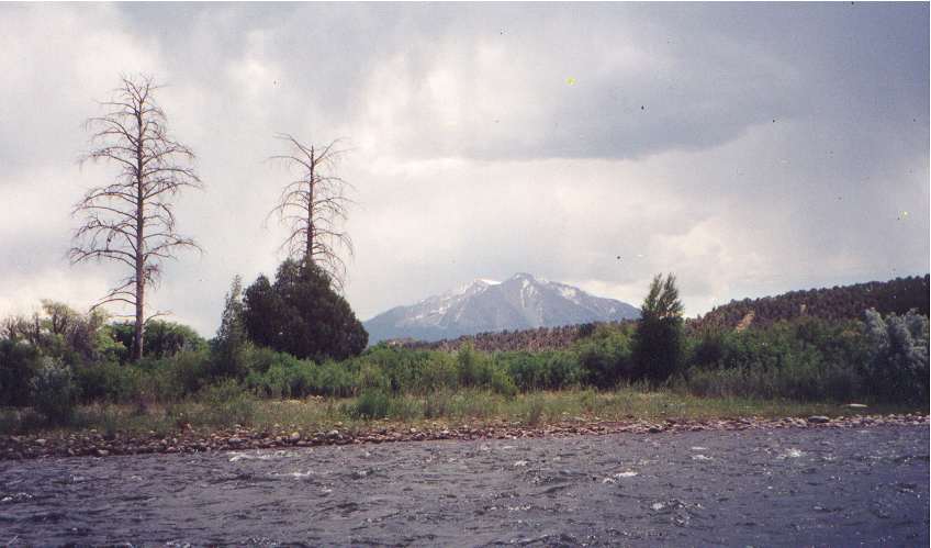
A view of Mount Sopris from the river, about 30 miles distant. The mountain lies
at the tip of the southern spur of the Elk Range, it towaers almost 13,000' and
dominates the Roaring Fork valley. June 2001.
Next Roaring Fork photo...
Back to our
outdoor index...
Back to dave and karin's home page....